


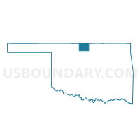
Voting District 11, Grant County, Oklahoma
About
Outline

Summary
| Unique Area Identifier | 654075 |
| Name | Voting District 11 |
| County | Grant County |
| State | Oklahoma |
| Area (square miles) | 91.90 |
| Land Area (square miles) | 91.90 |
| Water Area (square miles) | 0.00 |
| % of Land Area | 100.00 |
| % of Water Area | 0.00 |
| Latitude of the Internal Point | 36.88125060 |
| Longtitude of the Internal Point | -97.51461700 |
Maps


Graphs
Select a template below for downloading or customizing gragh for Voting District 11, Grant County, Oklahoma


Neighbors
Neighoring Voting District (by Name) Neighboring Voting District on the Map
- Voting District 26, Grant County, OK
- Voting District 29, Grant County, OK
- Voting District 405, Kay County, OK
- Voting District 406, Kay County, OK
- Voting District 417, Kay County, OK
- Falls Township Voting District, Sumner County, KS
- South Haven Township Voting District, Sumner County, KS
Top 10 Neighboring County Subdivision (by Population) Neighboring County Subdivision on the Map
- Blackwell CCD, Kay County, OK (8,080)
- Medford CCD, Grant County, OK (1,554)
- Lamont CCD, Grant County, OK (860)
- Braman CCD, Kay County, OK (674)
- South Haven township, Sumner County, KS (567)
- Falls township, Sumner County, KS (135)
Top 10 Neighboring Place (by Population) Neighboring Place on the Map
Top 10 Neighboring Unified School District (by Population) Neighboring Unified School District on the Map
- Blackwell Public Schools, OK (7,827)
- Caldwell Unified School District 360, KS (1,467)
- Medford Public Schools, OK (1,336)
- Deer Creek-Lamont Schools, OK (1,009)
- South Haven Unified School District 509, KS (879)
- Braman Public Schools, OK (624)
Top 10 Neighboring State Legislative District Lower Chamber (by Population) Neighboring State Legislative District Lower Chamber on the Map
- State House District 38, OK (32,291)
- State House District 79, KS (20,632)
- State House District 80, KS (20,532)
Top 10 Neighboring State Legislative District Upper Chamber (by Population) Neighboring State Legislative District Upper Chamber on the Map
Top 10 Neighboring 111th Congressional District (by Population) Neighboring 111th Congressional District on the Map
Top 10 Neighboring Census Tract (by Population) Neighboring Census Tract on the Map
- Census Tract 13.02, Kay County, OK (4,606)
- Census Tract 13.01, Kay County, OK (4,148)
- Census Tract 9565, Grant County, OK (3,052)
- Census Tract 9623, Sumner County, KS (2,568)
Top 10 Neighboring 5-Digit ZIP Code Tabulation Area (by Population) Neighboring 5-Digit ZIP Code Tabulation Area on the Map
- 73759, OK (1,468)
- 67022, KS (1,461)
- 67140, KS (802)
- 74643, OK (615)
- 74632, OK (578)
- 74636, OK (268)
- 74646, OK (233)